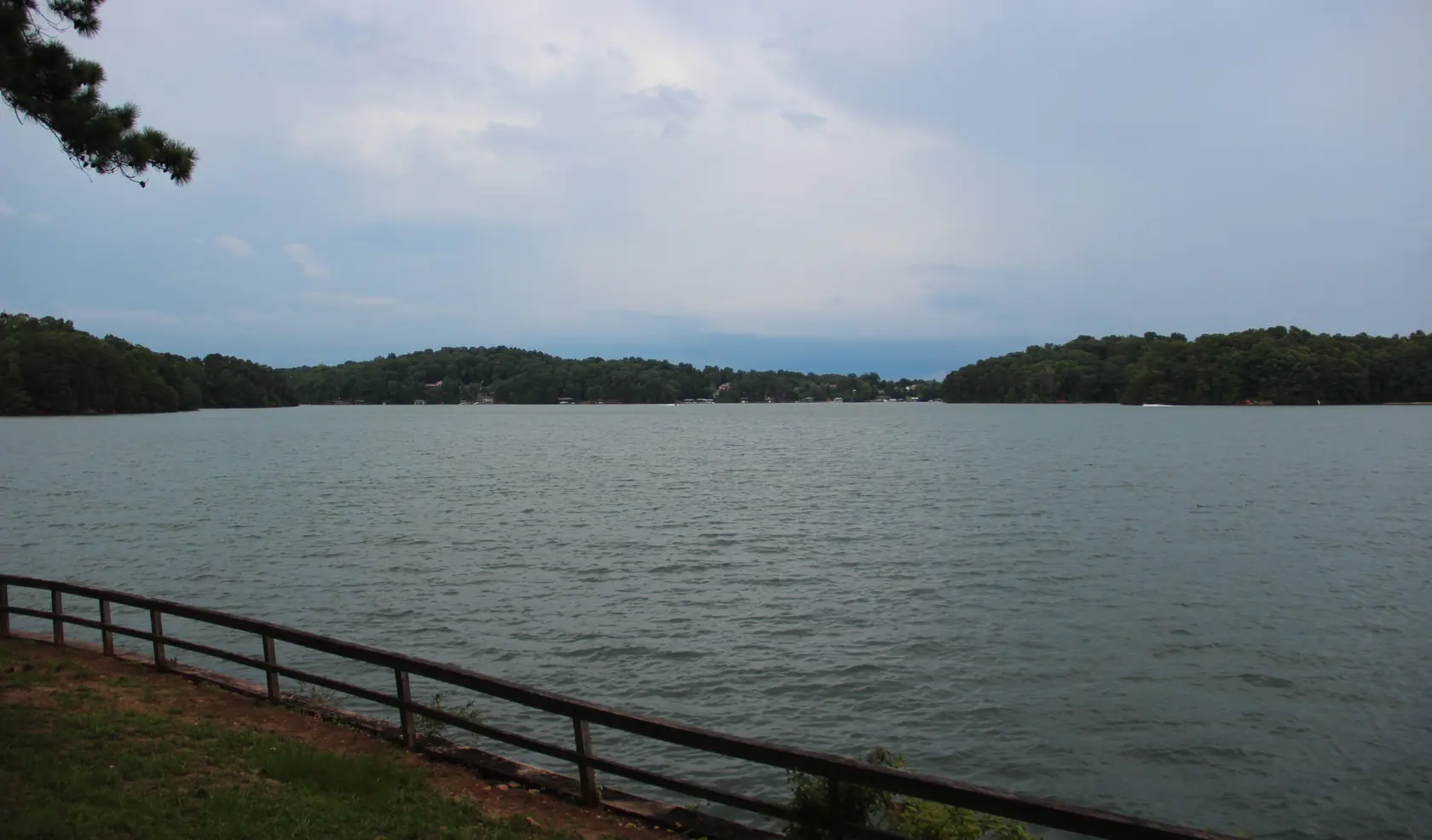
Buying a home on Lake Lanier is a two-part purchase. You buy the house and lot from the seller. The shoreline in front of it belongs to the federal government, and any dock on it exists only under a Corps permit in the owner’s name. This guide walks through the rules in the order a buyer meets them.
The Corps owns the shore
Who owns the land at the water
- The Shoreline Management Plan says the United States (the Corps) owns most of the land around Lake Lanier outright, in fee title. U.S. Army Corps of Engineers (archived page), checked 2026-10-19
- Private property lines do not extend onto Corps land. Owning the adjoining lot gives no extra rights on government property, no privacy guarantee and no exclusive use of the shoreline. U.S. Army Corps of Engineers (archived page), checked 2026-10-19
- The U.S. Army Corps of Engineers manages Lake Lanier's shoreline, mainly through the Lake Lanier Shoreline Management Plan, to protect public lands and waters while allowing a balanced use of the lakeshore. U.S. Army Corps of Engineers (archived page), checked 2026-10-19
So on most lots sold as “lakefront,” your property line stops at the Corps boundary, not at the water. The strip between the line and the lake is public land. Ask for a survey that shows the Corps boundary before you rely on any listing photo.
Shoreline zones decide what is possible
The Shoreline Management Plan zones the shoreline. Measured at 1,071 feet, about 47% is 'Limited Development' (353.83 miles), about 31.9% is 'Protected' and the rest is public recreation, Lake Lanier Islands and a small prohibited-access zone near the dam. (U.S. Army Corps of Engineers (archived page), checked 2026-10-19)
What each zone allows
- Private shoreline uses can be permitted only on 'Limited Development' shoreline, and even there the public cannot be kept off. Permit holders who try to block public use face enforcement and permit revocation. U.S. Army Corps of Engineers (archived page), checked 2026-10-19
- Private recreational facilities, docks among them, are not authorized on 'Protected' shoreline, which also covers all islands except those leased to Lake Lanier Islands. U.S. Army Corps of Engineers (archived page), checked 2026-10-19
- No private shoreline permits are granted in Public Recreation areas, which include Corps campgrounds and day-use parks, leased public lands and marinas. U.S. Army Corps of Engineers (archived page), checked 2026-10-19
The zone in front of the lot matters more than the lot itself. A lot facing Protected or Public Recreation shoreline cannot be permitted for a private dock, however close it sits to the water.
Who may apply for a dock permit
Eligibility under the 2004 plan
- Only owners of property next to public land zoned 'limited development' may apply for a Shoreline Use Permit/License. First-time applicants for new facilities must meet a ranger on site. New owners of existing facilities apply at the Corps office. U.S. Army Corps of Engineers (archived page), checked 2026-10-19
- For new private dock permits, the plan requires the lot to have at least 82 feet of private land adjoining public property, with unrestricted legal access to Limited Development land. This does not apply to existing platted lots that were already eligible unless they are modified. U.S. Army Corps of Engineers (archived page), checked 2026-10-19
- The plan allows one dock permit per household. Permits are not issued for speculative purposes, for property enhancement or to renters, and the permittee must be the owner and primary user. U.S. Army Corps of Engineers (archived page), checked 2026-10-19
Two of these rules catch buyers. The permittee has to be the owner and primary user, so a permit is not issued to a renter or held for resale. And the frontage rule is measured along the land that touches public property, not along the road.
Newer subdivisions use community docks
The plan makes community docks the preferred form of shoreline access and requires them for new residential developments (final plat approved after the plan took effect) where they reduce environmental impacts. After a community dock permit is issued, the remaining shoreline is rezoned 'Protected'. (U.S. Army Corps of Engineers (archived page), checked 2026-10-19)
Once a community dock is permitted, the rest of that shoreline becomes Protected, and Protected shoreline carries no private docks. In a newer lake subdivision, ask the HOA for the community dock permit and its slip rules rather than looking for a private one.
Why the permit ends when the house sells
The permit at a sale
- The Corps says shoreline permits and licenses last at most five years, cannot be transferred, give no real estate rights and no exclusive use of government property. Lake Lanier's shoreline is open to the general public. U.S. Army Corps of Engineers (archived page), checked 2026-10-19
- The Shoreline Management Plan says dock permits cannot be transferred. They become null and void when the property is sold or transferred, or when the permittee dies. New owners must notify the Corps of their purchase and apply for a new permit. U.S. Army Corps of Engineers (archived page), checked 2026-10-19
- The Corps' change-of-owner letter to buyers says the dock permit expired the day the name on the deed changed. It says not to install or change facilities, or cut vegetation or trees, without contacting the Corps first and getting written permission. U.S. Army Corps of Engineers (archived page), checked 2026-10-19
A dock in the listing photos is a structure, not a right. The day the deed records in your name, the seller’s permit is over and you start the change-of-owner process. Until the Corps writes back, do not add to the dock, move it or cut anything on the shoreline. Our journal walks through the timing in the dock permit at closing.
Documents the Corps asks new owners for
To start the change-of-owner process, the Corps asks for: the recorded deed with tax stamp (not a security deed), the current recorded survey or plat, your own hand drawing of the dock with all dimensions, a hand-drawn site map, an Exhibit C electrical certification if the permit requires one, and proof of authority for trusts, LLCs, estates or HOAs. A ranger then inspects the facilities and shoreline. (U.S. Army Corps of Engineers (archived page), checked 2026-10-19)
Most of that list comes out of your closing: the recorded deed and the survey or plat. The dock drawing and site map you make yourself. Ask the seller now whether the current permit requires the electrical certification, so you can line up an electrician early.
The Corps says it takes about 6 to 8 weeks to evaluate and process a permit application once it has the completed package. (U.S. Army Corps of Engineers (archived page), checked 2026-10-19)
What a dock can be
Dock design rules (2004 plan)
- New private docks must be open-sided, with no walls, and may not exceed 32 by 32 feet including any deck. Slips are capped at 20 by 28 feet, and the smallest dock permitted is 18 by 24 feet. U.S. Army Corps of Engineers (archived page), checked 2026-10-19
- Dock roofs and upper sundecks are allowed, but any covering that creates a second-level roof or room is prohibited. U.S. Army Corps of Engineers (archived page), checked 2026-10-19
- The plan requires boat-mooring sites to have six feet of water under the lakeside or slip end of the dock at full pool. U.S. Army Corps of Engineers (archived page), checked 2026-10-19
New docks are open-sided, and a second-level room is not allowed. If you are picturing an enclosed dock or a two-story one, plan around the rules above instead.
Lake levels
- Lake Lanier's full level is 1,071 feet above mean sea level. The Corps' recorded extremes are a high of 1,077.2 feet in April 1964 and a low of 1,050.79 feet in December 2007. U.S. Army Corps of Engineers (archived page), checked 2026-10-19
- The Corps says Lake Lanier's water level will periodically fluctuate as it balances hydropower, flood control, navigation, water supply, recreation and fish and wildlife needs. U.S. Army Corps of Engineers (archived page), checked 2026-10-19
The water-depth rule is measured at full pool. Lake levels go up and down, so water depth at any dock is not guaranteed. Look at the shoreline in a dry month if you can.
The dock cap and the wait-list
How many docks the shoreline can hold
- A Corps carrying-capacity study set the total number of private boat docks the Limited Development shoreline could hold at 10,615. The plan says no new permit requests will be accepted once that total is reached. U.S. Army Corps of Engineers (archived page), checked 2026-10-19
- The Corps limits how many shoreline permits can exist on the lake at one time. When none are available, applicants can join a wait-list. U.S. Army Corps of Engineers (archived page), checked 2026-10-19
We could not find a current count of permitted docks against that cap. If you are buying a lot without a dock and hoping to add one, ask the Corps about availability and the wait-list for that stretch of shoreline before you set your offer price on it.
What you cannot do on Corps land
Work on Corps property needs a permit first. The Corps lists clearing trees and understory, planting non-native or ornamental plants, placing unpermitted items such as swings, picnic tables, benches, sheds or boat trailers, and grading among prohibited acts. Violators face fines of up to $5,000, up to six months' imprisonment, restoration costs or permit revocation. (U.S. Army Corps of Engineers (archived page), checked 2026-10-19)
Some older shoreline items are 'grandfathered' only and get no new authorizations: boat launching ramps, shoreline access roads, marine rails, patios, pumphouses, wells, picnic shelters, hand rails and land-based boathouses. Such an item must be removed when it becomes unsafe or unusable. (U.S. Army Corps of Engineers (archived page), checked 2026-10-19)
Walk the shoreline with the seller. A cleared path, a bench, a swing or a shed on Corps land should show up in the permit, or it is a question for the Corps. The change-of-owner process ends with a ranger inspecting the facilities and the shoreline, so it is better to find a problem before you close.
The 1,085-foot line and septic
Flowage easements
- When Buford Dam was built, a maximum flood elevation of 1,085 feet above mean sea level was set. Where that line fell on private land, the government bought flowage easements. That land stays private, but owners may not build habitable structures on it or alter its contour. All purchased easements are recorded. U.S. Army Corps of Engineers (archived page), checked 2026-10-19
- The plan says health officials around Lanier prohibit new septic systems below the 1,085-foot contour regardless of who owns the land. Septic systems are not permitted on public land below 1,085 feet. U.S. Army Corps of Engineers (archived page), checked 2026-10-19
Check the survey and the title work for a recorded flowage easement, and find out where the septic tank and drain field sit. The 1,085 line explained covers what the easement means for additions and repairs. The FEMA flood map is a separate check.
FEMA's Flood Map Service Center (msc.fema.gov) is the official public source for National Flood Insurance Program flood hazard information. Buyers can search an address there to find the effective flood map. (FEMA, checked 2026-10-19)
What to ask before you offer
- Ask the seller for the dock permit number, a copy of the current permit and any letters from the Corps.
- Check the Corps permit record for that lot with the Lake Lanier Project Management Office (contacts below).
- Ask which shoreline zone fronts the lot. Only Limited Development shoreline can carry a private dock.
- Order a survey that shows the Corps boundary and the 1,085-foot line, and ask your closing attorney to look for a recorded flowage easement.
- Compare the dock you see with the size and features on the permit.
- Ask whether the permit requires an electrical certification.
- Look for anything on Corps land that is not on the permit: paths, benches, cut trees, sheds, boat trailers.
- In a newer subdivision, ask the HOA for the community dock rules.
- If the home is on septic, get the county septic record and find the tank relative to the 1,085-foot line.
- Gather the change-of-owner documents so you can file as soon as the deed records.
Who to call
The Corps tells lakefront owners to get permits from the Lake Lanier Project Management Office before doing any work on public property. That office also handles dock, riprap and small silt-removal permits. The Shoreline Management Help Desk number is 770-904-3262. (U.S. Army Corps of Engineers (archived page), checked 2026-10-19)
Lake Lanier Project Management Office (U.S. Army Corps of Engineers)
Dock and shoreline permits
Shoreline Management Help Desk 770-904-3262
Source: U.S. Army Corps of Engineers (archived page), checked 2026-10-19
City of Flowery Branch Utility Billing
City water and sewer service · Flowery Branch
Apply in person at City Hall, 5410 Pine Street
Source: City of Flowery Branch, checked 2026-10-19
Hall County Environmental Health
Septic records
Requests by email with the property address
Source: Hall County, checked 2026-10-19
Hall County Tax Assessors
Homestead filings and assessment appeals
Own and occupy on January 1; apply by the end of the 45-day appeal window
Source: Hall County, checked 2026-10-19
City of Flowery Branch Historic Preservation Commission
Certificates of Appropriateness in Old Town · Flowery Branch
Source: City of Flowery Branch, checked 2026-10-19
Hall County Schools
School attendance zones
Source: Hall County Schools, checked 2026-10-19
Every dock rule on this page comes from the Corps’ 2004 Shoreline Management Plan and its permit pages. The Corps lists a later change to one section of the plan that we could not read. Confirm the current rule with the Corps before you rely on it.
Questions buyers ask
Does a Lake Lanier dock permit transfer when I buy a Flowery Branch home?
No. The Corps’ Shoreline Management Plan says dock permits cannot be transferred and become void when the property is sold. The new owner must notify the Corps of the purchase and apply for a new permit.
Do I own the shoreline if I buy a lakefront lot on Lake Lanier?
Usually not. The Corps owns most of the land around Lake Lanier outright, and private property lines do not extend onto Corps land. Owning the lot next to it gives no exclusive use of the shoreline.
Who can apply for a dock permit on Lake Lanier?
Only owners of property next to public land zoned Limited Development may apply for a Shoreline Use Permit. First-time applicants for new facilities meet a ranger on site; new owners of existing facilities apply at the Corps office.
How long does the Corps take to process a dock permit?
The Corps says about six to eight weeks once it has the completed application package.
What is the 1,085-foot line on a Lake Lanier lot?
It is the maximum flood elevation set when Buford Dam was built. Where it fell on private land, the government bought flowage easements: the land stays private, but no habitable structures may be built on it and its contour may not be changed.
Can new lakefront subdivisions have private docks?
The Corps plan prefers community docks and requires them for new residential developments where they reduce environmental impacts; the remaining shoreline is then rezoned Protected.
Next step
Run the address through the buyer due-diligence checker, which adds the Corps questions for lake lots, then read the Lake Lanier homes guide for the lake side of town.
Rules, rates and maps change. Every rule on this page links to the office that sets it; confirm with that office before you rely on it.